Watch As We Suck Off Earth's Fluids.
Share
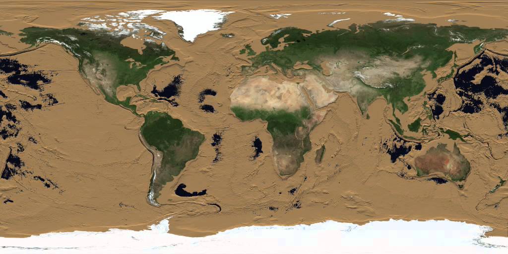
What if Earth had all of its fluids magically sucked into the sky and left barren ocean floors bare for all to see?
Well, stop wondering with this mesmerizing animation from JAXA's James O'Donoghue.
The planetary scientist editied this short video to highlight Earth's incredible unseen features from the world's longest mountain range to its Ice Age-era land bridges that allowed humans to cross to new continents.
The original, created by NASA's Horace Mitchell in 2008 had alternate timing whereas O'Donoghue's is sped up in relative parts with a tracker to account for the passage of time.
As the ocean level falls, the continental shelves - or the edges of Earth's continents - are the first to show.
Within the first ten metres of water loss, most of Earth' shelves are exposed including the land bridges we humans used to traverse continents tens of thousands of years ago.
After the thawing of the last ice age, these bridges were submerged under the new sea level we know today.

Beginning at around 2.500 metres, Earth's "stitches" or the fault lines between tectonic plates appear as huge volcanic mountain ranges in the sea.
Over 90% of Earth's largest mountain range is found beneath the Pacific Ocean.
You'll also notice that even when the majority of Earth's water is gone at 6,000 metres, it still takes another 5,000 metres (11,000 total!) to drain the Marianas Trench located between Japan and Papua New Guinea.

This style of animation allows the common person unprecedented insight into how interesting and varied the Earth's surface is even when submerged by our oceans.
It is a glimpse of the Earth without its precious lifeblood and left dry as a bone.
#Space_Aus


